By Dr. Jessica Thorn and Cara Steger —
In April 2018, the annual meeting of the American Association of Geographers (AAG) attracted approximately 8,500 researchers, GIS specialists, industry professionals, authors, and other leaders in geography from around the globe. We convened to present and receive feedback on the latest scholarship, learn about current methods and theories, network within specialty groups, and collaborate on projects and publications. This year, the meeting was held in New Orleans: an engineered landscape and one of the United States’ most iconic, hazardous, and resilient cities.
It was a colorful representation of the breadth of the discipline. Sessions ranged from urban, physical, digital and critical geography, animal agency and representation, extreme weather events and health, agro-biodiversity conservation, power and ideology, amongst others. The environment cultivated opportunities to build interdisciplinary bonds and new professional connections. Keynote presentations from distinguished geographers covered Foreign Direct Investment in development; “capitalism nature socialism” the commons; sexuality; and space. Training and mentorship workshops focused on building research and teaching capacities. The exhibit hall showcased recent publications, new leading geographic technologies and allowed authors to interact with potential publishers. One participant described it as the Olympic games of geographers! It is no wonder why AAG is considered to be one of the most important geography meetings in the world.
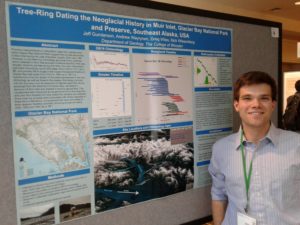
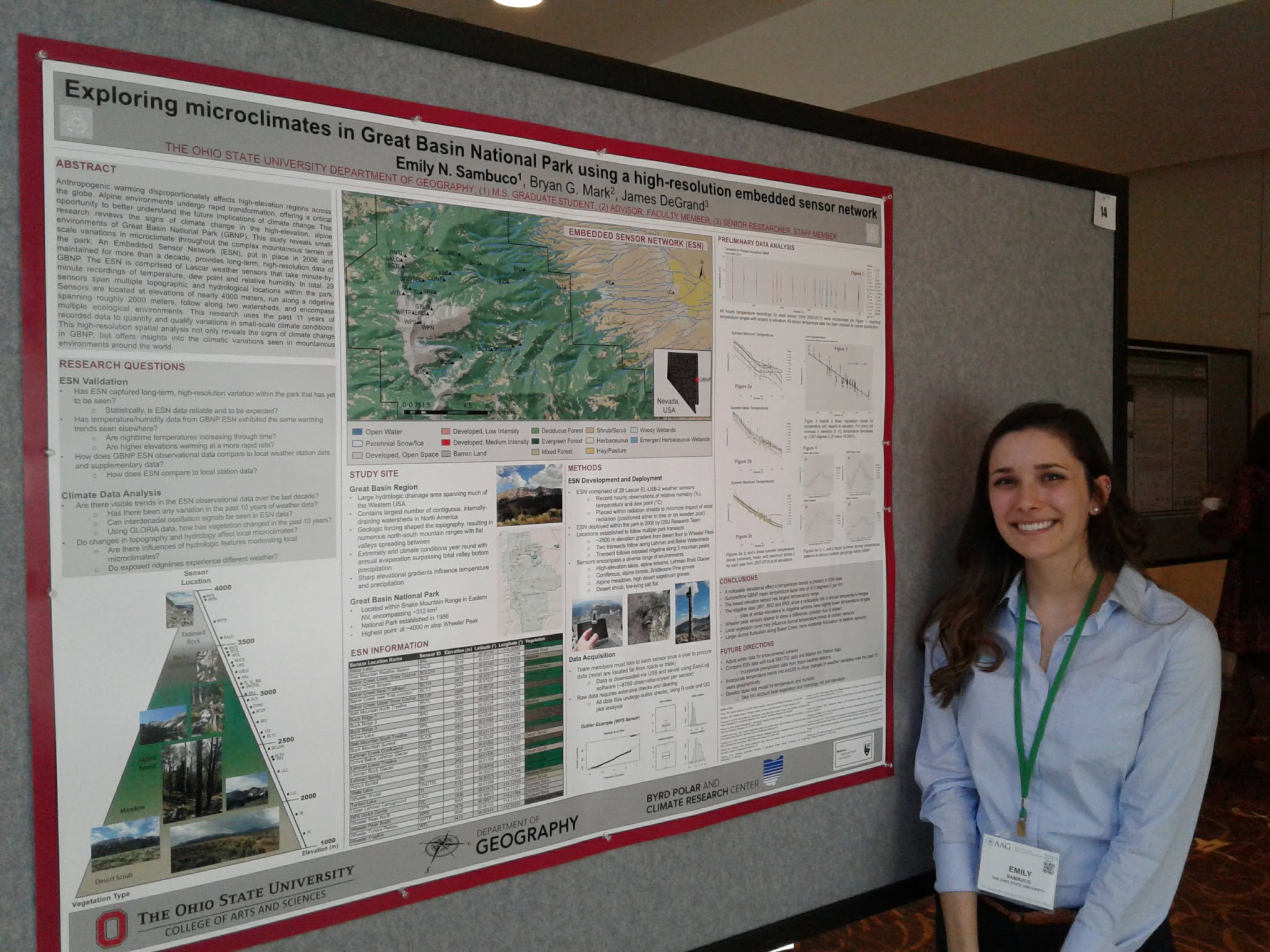
Poster sessions showcased the work of student Jeff Gunderson (Photo: B. Mark)
Key themes
This year the AAG Council selected three key themes to focus the discussion. The first was “Black Geographies”. The historical backdrop offered a rich opportunity to explore the past, present and future political environment: of black slavery and resistance; the American Civil War; Reconstruction; and counter-revolution. Field trips instigated conversation about recent removals of Confederate monuments from public spaces. We discussed how memorials (re) define place in space and time, negotiating historical and geographical narratives about cities and the American South. We also learned about New Orleans’ distinctive character rooted in the colonial period – enriched by traditions from Europe, Africa, the Caribbean and West India. From this mix emerged jazz, the blues, brass marching bands, vernacular dance styles, Mardi Gras, “Creole of color”, and the French Quarter (Vieux Carre). The International Reception was a perfect opportunity to experience first hand New Orleans’ rich ethnic and cultural makeup, when James Martin and his band featured live brass band music. Derek Alderman’ presidential plenary was thus appropriately titled “When the Big Easy isn’t so easy: Learning from New Orleans’ geographies of struggle”.
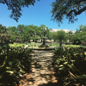
Several fieldtrips offered options to explore the distinctive cultural and physical geography of New Orleans (Photo: Bryan Mark).
Several fieldtrips offered options to explore the distinctive cultural and physical geography of New Orleans (Photo: Bryan Mark).
Another theme was “Hazards, Geography and GIScience”. It explored the myriad of challenges presented by growing hazards, and how geographers are well equipped to research and apply their work. Hurricane Katrina struck New Orleans in August 2005, leaving 1,464 dead, 135 missing, and hundreds of thousands of survivors. Much of the city was destroyed. The economic consequences were significant, and half a million cubic yards of debris were removed. In addition to climatic drivers, poor environmental management exacerbated impacts. For example, up to 67% of sediment was lost in the Gulf of Mexico due to upstream dam and levee construction preventing wetlands regeneration. Land was drained for development causing soil subsidence, erosion, and salt intrusion. We learned about recovery efforts, the evacuation process, and new control structures to “build back better”.
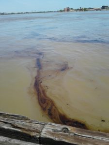
In the midst of these conversations, it was quite timely that a 10-mile stretch of the Mississippi River in downtown New Orleans was closed after a vessel spilled oil into the river (Photo: B. Mark).
The third theme of the conference was “Public Engagement in Geography”. This theme addressed how to expand/enhance public outreach/engagement on environmental, technological, and social issues. Session topics included storytelling, public programming, evidence-based advocacy, filmmaking, and public geographic ethics. We discussed practical strategies, challenges, and larger political implications for geographers interacting with the public.
Special Session on Mountains
Mountain Sentinels hosted and presented at a series of three sessions on ”Changing Landscapes and Livelihoods in Mountain Regions”, co-organized by Cara Steger (PhD student at Colorado State University) and Aaron Groth (PhD student at University of Texas), both of whom are part of the Early Career Mountain Sentinels group. These sessions explored biophysical and social changes in mountain systems from a variety of disciplinary perspectives.
- The first session emphasized bridging local/cultural and extra-local/scientific knowledge, the ecological impacts of political and socio-economic change, and the resulting post-Soviet/Socialist environmental identities in Tajikistan and Ethiopia. For example, Cara Steger’s paper highlighted the barriers to representing local knowledge through participatory mapping, questioning whether this method was appropriate in a culture that does not even have a word for “map”.
- The second session engaged more deeply with market and climatic drivers of change, and the “explicit and implicit violence experienced in mountains”. For example, Dr. Bilal Butt drew our attention to the ways in which the state is complicit in encouraging inexperienced mountain climbers and porters to ascend too rapidly to avoid fees, endangering their health from altitude-related illness and rockfall hazards caused by retreating glaciers.
- In the third and final session, presenters focused on political drivers and biophysical evidence of change in the Andes and Central America. Dr. Jessica Thorn finished the session with a presentation of the Mountain Sentinels’ recent work reviewing participatory scenario analysis and building Bayesian models, with broad implications for understanding the increasingly uncertain future of mountain regions.
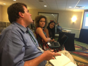
Discussion during “Changing Landscapes and Livelihoods in Mountain Regions” sessions .(Photo: C. Steger)
Finally, Dr. Bryan Mark led a discussion reflecting on the challenges, opportunities, and limitations of moving toward transdisciplinary research in mountain regions. As true transdisciplinarity involves co-generating science questions and designing solutions with stakeholders, he asked us to reflect on our positionality: Are we conducting research with an agenda? Should science have an agenda? Do we defy the process by compromising objectivity? We discussed the responsibility researchers have to present our research in ways that make it accessible to the people who need it most. Given limits on funding, scope, and access he stressed the need for open access data, and citizen science. Dr. Mark drew our attention to the need for data integration and explicit accounting of uncertainty in our models and forecasts. He encouraged us to explore the frontiers of technology and its role in monitoring remote mountain regions. He pointed out that historical data are important, they are often difficult to obtain, lack of continuity and increasingly unreliable as “no-analog” scenarios continue to unfold. This challenges our ability to anticipate future change and requires new approaches to imputation accounting for uncertainty.
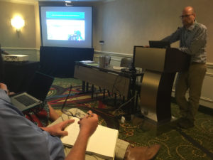
Dr. Bryan Mark led an inspirational discussion reflecting on transdisciplinary research in the current state of rapid, unprecedented social-ecological change (Photo credit: Cara Steger).
Our sessions concluded with the encouragement to embrace the diversity of resources in mountain regions by including practitioner knowledge and integrating data from various sources. This may allow us to reach a more comprehensive and enriched picture of change in mountains. We look forward to continuing this conversation at next year’s meeting in Washington D. C.!